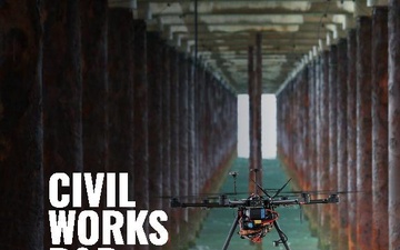
It’s estimated that up to ten percent of ordnance does not detonate when it impacts training ranges and combat zones. That means that even after a conflict or live-fire training are over – sometimes even decades later – unexploded bombs, missiles, and artillery shells still pose a deadly threat to military personnel and civilians.
Finding them and cleaning them up, usually done by personnel on the ground, is dangerous work.
But a team of researchers from the U.S. Army Engineer Research and Development Center’s Cold Regions Research and Engineering Laboratory (CRREL) and Dartmouth College is pioneering a new way to keep humans out of harm’s way by using drones to find and identify unexploded ordnance.
“We use...