
Story by Melanie Peterson | U.S. Army Corps of Engineers, Los Angeles District | 05.17.2025
Turning complicated data into an easy-to-use and interpret product can be extremely difficult, especially in an emergency response. That’s where Joseph “GIS Joe” DiRenzo comes in. DiRenzo is a geographer with the U.S. Army Corps of Engineers and is deployed to Los Angeles County to help with the 2025 Southern California wildfires recovery process....
Story by William Brugge | Fort Benning Public Affairs Office | 02.21.2025
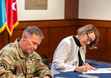
FORT MOORE, Ga. – The Maneuver Center of Excellence and U.S. Army Garrison Fort Moore hosted the ceremonial signing of the first intergovernmental support agreement with Columbus State University, Feb. 13, 2025. This agreement, the first of its kind between Fort Moore and an entity within Muscogee County, aims to enhance the installation's geospatial information system (GIS) services in......

Story by Stacey Reese | U.S. Army Corps of Engineers Honolulu District | 04.12.2024
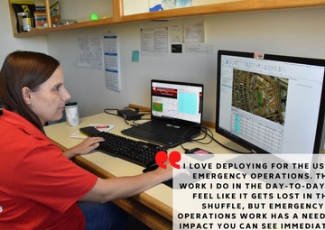
LAHAINA — As a geographic information specialist, Meg Ryan helps ensure that all team members have access to necessary geospatial platforms for their roles in disaster response....
Story by Elizabeth Lockyear | U.S. Army Corps of Engineers Honolulu District | 12.09.2023
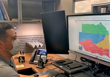
Lisa Hook, a cartographer from the U.S. Army Corps of Engineers Kansas City District is supporting the Hawai‘i Wildfires recovery mission on Maui....

Story by Brannen Parrish | U.S. Army Corps of Engineers Honolulu District | 09.11.2023
For commanders, the value of actionable information is immense as they frequently receive requests for information from the Department of Defense, the Federal Emergency Management Agency, local governments, the public and Congressional delegations. The U.S. Army Corps of Engineers is using Geographic Information Systems to provide a common operating picture for responders and commanders on......

Story by Zachary Mott | 88th Readiness Division | 12.08.2022
Compiling all of the various data points for an Army Reserve organization spread across 19 states and supporting more than 275 facilities is an arduous task for even the most robust of teams....
Story by Stacey Reese | U.S. Army Corps of Engineers, Tulsa District | 11.19.2021
TULSA, Okla. — First held on November 19, 1999 in conjunction with Geography Awareness Week, GIS day is a worldwide event that celebrates the technology of Geographic Information Systems. This year Geography awareness week is November 15-19, and National GIS day was celebrated on November 17...

Story by Tech. Sgt. BEAU SPENCER | 113th Wing D.C. Air National Guard | 10.13.2020
Submission of Applied Geospatial Information Systems to the 2020 Spark Tank.