
 Subscribe
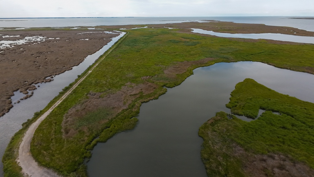
Marsh grasses established at the Deal Island Wildlife Management Area in Somerset County, Md., are shown July 9, 2026, following a multi-year U.S. Army Corps of Engineers, Baltimore District, wetland restoration project. Dredged material from the Wicomico River navigation channel was used to rebuild the eroded marsh, which was then planted with native vegetation to restore bird nesting habitat. (U.S. Army photo by Jeremy Todd)
| Date Taken: | 07.14.2026 |
| Date Posted: | 07.14.2026 12:02 |
| Photo ID: | 9809825 |
| VIRIN: | 260709-A-SE916-1002 |
| Resolution: | 4000x2256 |
| Size: | 2.02 MB |
| Location: | DEAL, MARYLAND, US |
| Web Views: | 43 |
| Downloads: | 4 |

This work, From Dredge to Delta: USACE, Partners Restore Over 70 Acres of Wetlands at Deal Island Wildlife Management Area [Image 8 of 8], by Jeremy Todd, identified by DVIDS, must comply with the restrictions shown on https://www.dvidshub.net/about/copyright.


No keywords found.




