
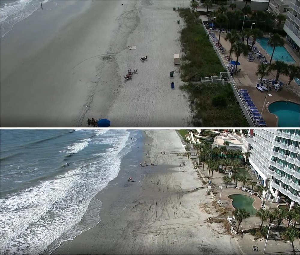
A photographic comparison highlights the beach profile near Sandy Beach Resort between 2nd Avenue South and 3rd Avenue South before Hurricane Ian on Sept. 28, 2022 (top), and the storm-induced berm loss and scarping on Oct. 1, 2022 (bottom). Hurricane Ian generated nearly six feet of storm surge and significant dune erosion along the Grand Strand, prompting the U.S. Army Corps of Engineers, Charleston District to conduct post-storm coastal storm risk management assessments on engineered berms and protective dunes.
| Date Taken: | 09.28.2022 |
| Date Posted: | 09.17.2026 09:22 |
| Photo ID: | 9944108 |
| VIRIN: | 220928-A-SL031-1002 |
| Resolution: | 1949x1658 |
| Size: | 909.06 KB |
| Location: | MYRTLE BEACH, SOUTH CAROLINA, US |
| Web Views: | 8 |
| Downloads: | 0 |

This work, Pre- and Post-Storm Imagery Captures Hurricane Ian Beach Erosion Near Sandy Beach Resort [Image 2 of 2], by Dylan Burnell, identified by DVIDS, must comply with the restrictions shown on https://www.dvidshub.net/about/copyright.


Holding the Line: The Sacrificial Sands of the Grand Strand
No keywords found.





