
 Subscribe
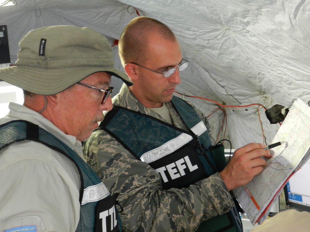
More than MapQuest – It’s a collaborative effort to determine the best location to collect a sample of the simulated nuclear fallout with numerous factors considered. Key members of the decision-making process include subject matter experts from the Department of Energy and Air Force Technical Applications Center, like George Brooks (left) a DOE team lead and Capt. William “Billy” Bauer, a technical event field leader from Patrick Air Force Base, Fla. Samples are obtained by air, using an Air Force WC-135 Constant Phoenix (an aerial platform that collects debris from nuclear weapons detonations) or by ground, from collection teams dressed head-to-toe in protective gear and armed with radiation detection and collection equipment.
| Date Taken: | 07.28.2012 |
| Date Posted: | 08.10.2012 11:59 |
| Photo ID: | 642797 |
| VIRIN: | 120728-A-1741M-039 |
| Resolution: | 4000x3000 |
| Size: | 2.12 MB |
| Location: | JEFFERSON PROVING GROUND, INDIANA, US |
| Web Views: | 154 |
| Downloads: | 9 |

This work, Nuclear professionals move in the direction of danger – a photo story [Image 10 of 10], by LTC Carol McClelland, identified by DVIDS, must comply with the restrictions shown on https://www.dvidshub.net/about/copyright.


No keywords found.




