Story by Staff Sgt. ShaTyra Reed-Cox | Joint Task Force Southern Guard | 02.22.2025
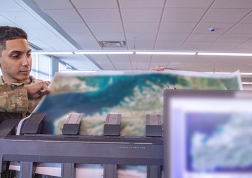
NAVAL STATION GUANTANAMO BAY, Cuba – Clear, accurate, and up-to-date intelligence, no matter the location is important. The easiest, most effective way to gain this intelligence is through visualization. That means having the right maps, imagery, and geospatial data is the number one priority for the small but mighty team of three geospatial engineers who make up the geospatial......
Story by Senior Airman Abbey Rieves | 17th Training Wing | 04.20.2020
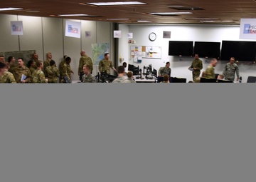
“Operation Lonestar is the intelligence, surveillance and reconnaissance capstone for our four pipeline courses,” said Capt. Steven Ishmael, 315th Training Squadron integrated operations exercise flight commander. “It’s an integrated environment for the All Source Intelligence Analysts, the Geospatial Intelligence Imagery Analysts, Targeting Analysts and Intelligence Officers.”...
Story by John Higgins | Capability Program Executive - Intelligence & Spectrum Warfare | 08.13.2018
"We’re always looking for ways to improve,” Herbert said. “Supportability, life-span, quality, the intel it can pull in, all those things we always want to make better. With any technology, it gets ‘old’ fast, just like your phone or computer, so we’re keeping the technology relevant.”...

Courtesy Story | National Geospatial-Intelligence Agency | 08.07.2014
National Geospatial-Intelligence Agency Director Letitia A. Long was presented the Knowlton Award for intelligence excellence Aug. 7 at the agency’s Springfield, Virginia, headquarters....
Courtesy Story | National Geospatial-Intelligence Agency | 08.07.2014
National Geospatial-Intelligence Agency Director Letitia A. Long was presented the Knowlton Award for intelligence excellence Aug. 7 at the agency’s Springfield, Virginia, headquarters....
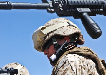
Story by James Katzaman | Marine Corps Systems Command | 09.10.2013
Sharing information among agencies is a good way to make sure that, in the operational environment, everybody is on the same page. This is why the Marine Corps is stepping out with its portion of the Distributed Common Ground/Surface System to link intelligence, surveillance and reconnaissance systems to analysts in the Corps and the other military services....
Story by OR-6 Mark Doran | Combined Team Uruzgan | 07.16.2013
Australian Army geospatial technicians in Tarin Kot are responsible for the collection, analysis and dissemination of geospatial intelligence for Combined Team Uruzgan (CTU)....