
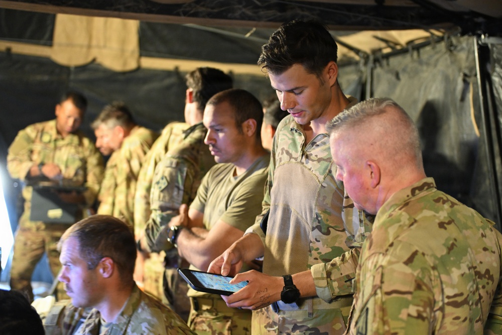
Photo By Nina Borgeson | A U.S. Army Soldier assigned to the 4th Combat Aviation Brigade demonstrates the use...... read more read more
FORT IRWIN, Calif.— In contested airspace, the side that coordinates faster wins. To turn combat power into decisive action faster than the enemy, the Army relies on real-time airspace management to instantly deconflict aircraft, drones, and artillery trajectories (fires)—ensuring commanders can simultaneously mass fires and maneuver without the friction of manual coordination.
Operating across multiple command post nodes from division headquarters to the tactical edge at Fort Irwin during Project Convergence Capstone 6 (PC-C6), 4th Infantry Division (4ID) Soldiers demonstrated this capability by utilizing the Realtime Airspace Management Suite (RAMS) to orchestrate a complex multi-domain battlefield. By planning, synchronizing, and viewing live aviation corridors with fires on a single screen, Joint Air-Ground Integration Center (JAGIC) operators successfully eliminated legacy coordination delays, reducing deconfliction time from more than 45 minutes for a well-trained cell to under 5 minutes, enabling simultaneous, lethal execution of fires and maneuver.
As the Army continues to modernize its approach to multi-domain operations, managing the complex airspace within the division’s battlespace has become critical to survivability and lethality. Enter the Realtime Airspace Management Suite (RAMS). Coined by the 4th Infantry Division (4ID) and designed to meet Maneuver Air’s (MA) modernization requirements, RAMS is a comprehensive suite of multiple applications developed by several commercial partners coming together. It scales from the tactical edge with Aviation Mission Planning—including Launched Effects (LE) and Uncrewed Aerial Systems (UAS), all the way up to dynamic, division-level airspace management.
Predictive Analysis at the Speed of War
Operating seamlessly within the Next Generation Command & Control (NGC2) ecosystem, the core advantage of RAMS is its intuitive interface and advanced predictive analysis capability. The software consolidates airspace control measures, fires control, maneuver graphics, Position Location Information (PLI), timelines, and travel corridors into a single Common Operating Picture (COP).
This transition adapts the tactical network to a true agile architecture where commanders see the battlefield in real time. By performing rapid, physics-based analysis on this live data, RAMS provides the ability to transform the tactical timeline. A process that previously required multiple personnel, risked human error, and demanded excessive stovepiped manual coordination is now calculated in minutes, enabling Army Aviation and ground commanders to make quicker, highly informed decisions when every second counts.
A Blueprint for Rapid Acquisition
RAMS represents a major shift in how the Army acquires and develops technology. Historically, capability development has followed a strict, linear timeline through waterfall methodology. With RAMS the Aviation Future Capability Directorate (AFCD) three divisions (Experimentation, Concepts, and Requirements) are moving in sync through an agile user-centric development process. This concurrent approach provides a highly successful blueprint that the AFCD and its partners can leverage to accelerate other priorities in the future.
“The success we have seen with RAMS is a result of using agile methodology, which is a first for Army Aviation,” stated Chief Warrant Officer 5 Christopher Crawford, the Senior Warrant Officer for Aviation Requirements, Aviation Future Capability Directorate (AFCD). “This work will help inform all software modernization efforts for us going forward.”
Iterative Testing to Operational Reality
The rapid maturity of RAMS proves the value of the Army’s commitment to persistent, soldier-led experimentation. Development began during Project Convergence Capstone 5 (PC-C5) in 2025. Since then, 4ID rigorously stressed the system during their Ivy Sting exercises, utilizing live operational feedback to iteratively improve the software leading into and through PC-C6.
Replacing Legacy Systems
Backed by the data and lessons learned from PC-C6, this capability is ready for its next step: integrating into the operational force. The Army plans to replace existing legacy software with this modern, intuitive architecture, allowing Soldiers and leaders to begin hands-on training.
As the underlying NGC2 mesh network matures to rapidly share data across the organization, the planned inclusion of LE and UAS will fully expand this mission planning and airspace management capability across the division.
“Ultimately, by replacing rigid, slow legacy tools with a real-time agile software architecture, the Army is giving commanders true decision dominance over peer adversaries,” said Col. Jason Raub, Director, AFCD. “Fusing planning and airspace data in minutes instead of hours means the Joint Force can strike targets faster, better protect friendly forces, and out-pace the enemy’s tempo in highly contested environments.”
| Date Taken: | 07.28.2026 |
| Date Posted: | 07.28.2026 12:52 |
| Story ID: | 570883 |
| Location: | FORT IRWIN, CALIFORNIA, US |
| Web Views: | 27 |
| Downloads: | 0 |

This work, When Seconds Count: Realtime Airspace Management Suite (RAMS) Accelerates Decision Dominance, by Nelson Ballew, identified by DVIDS, must comply with the restrictions shown on https://www.dvidshub.net/about/copyright.


No keywords found.





