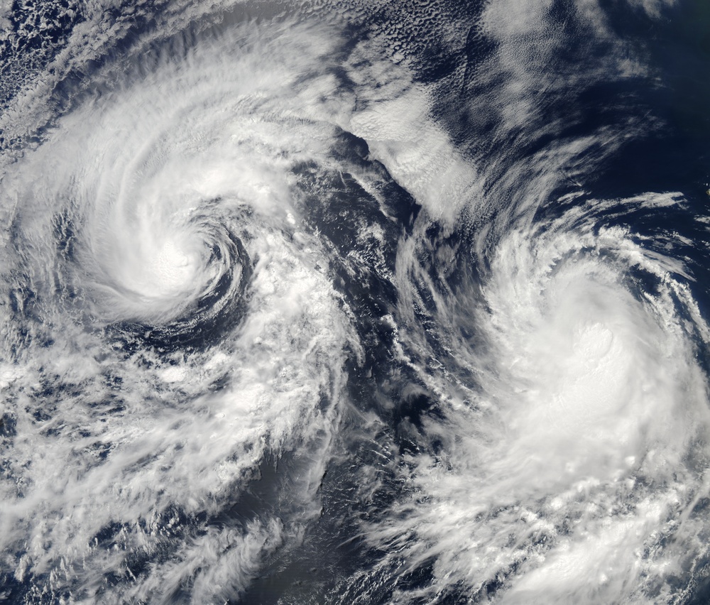
Tropical Storms Boris (right) and Christina (left) appeared together in the eastern Pacific Ocean several hundred kilometers off the Mexican coast on June 28, 2008. The Moderate Resolution Imaging Spectroradiometer ( modis.gsfc.nasa.gov MODIS ) on NASA's aqua.nasa.gov/ Aqua satellite showed the pair of spiral storm systems. Neither storm posed a significant danger to coastal communities. Boris and Christina never reached hurricane strength, and after forming off the Mexican coast, both took westerly tracks away from land. Both storms lost strength over the next two days. By June 30, the University of Hawaii's www.solar.ifa.hawaii.edu/Tropical/tropical.html Tropical Storm Information Center was reporting that Boris was still a tropical storm, although weakened, while Christina was at tropical depression strength. Neither storm was expected to reorganize and gain strength.
The high-resolution image provided above is at MODIS' full spatial resolution (level of detail) of 250 meters per pixel. The MODIS Rapid Response System provides this image at rapidfire.sci.gsfc.nasa.gov/gallery/?2008180-0628/BorisCristina.A2008180.2130 additional resolutions.
NASA image by Jeff Schmaltz, rapidfire.sci.gsfc.nasa.gov MODIS Rapid Response Team, Goddard Space Flight Center. Caption by Jesse Allen.
| Date Taken: | 08.07.2011 |
| Date Posted: | 02.08.2013 08:56 |
| Photo ID: | 842192 |
| Resolution: | 8920x7600 |
| Size: | 62.21 MB |
| Location: | WASHINGTON, D.C., US |
| Web Views: | 7 |
| Downloads: | 1 |
