
(e.g. yourname@email.com)

Forgot Password?

    Digital Visual Information Distribution System Logo

    Proposed Fish Passage Project Would be First of its Kind on Upper Mississippi River System

    Issued by: on

    VIRIN:
    Date Created:
    City:
    State:
    Country:
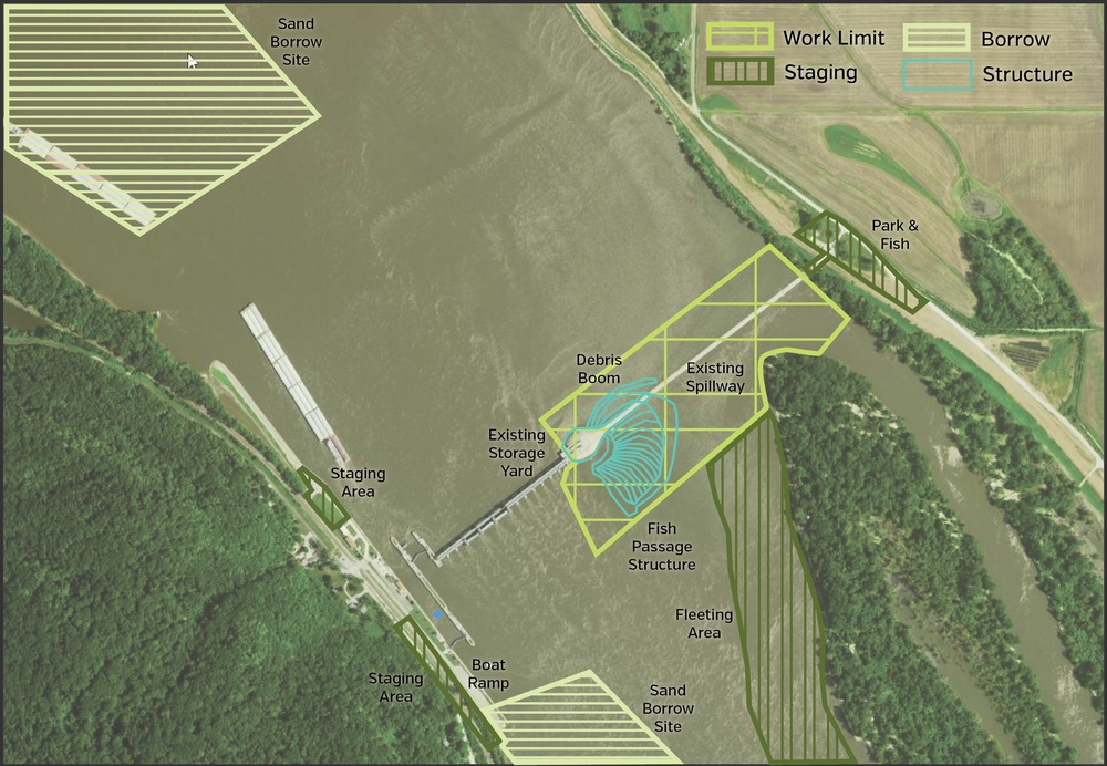
    This is an aerial/satellite project planning map showing a river infrastructure site with overlaid construction and work zone designations. The map depicts a dam or lock facility with labeled zones including fish passage structures, staging areas, borrow sites, and spillway locations. Color-coded overlays indicate work limits, staging areas, borrow zones, and structures per the legend.

    ROCK ISLAND ARSENAL, ILLINOIS, UNITED STATES

    07.06.2021

    Photo by Samantha Heilig 

    U.S. Army Corps of Engineers, Rock Island District

    Proposed map of the fish passage project at Lock and Dam 22 near Saverton, Missouri.

    IMAGE INFO

    Date Taken: 07.06.2021
    Date Posted: 07.06.2021 16:15
    Photo ID: 6722539
    VIRIN: 210706-A-VX113-003
    Resolution: 3677x2545
    Size: 1.94 MB
    Location: ROCK ISLAND ARSENAL, ILLINOIS, US

    Web Views: 36
    Downloads: 5

    PUBLIC DOMAIN




