
(e.g. yourname@email.com)

Forgot Password?

    Digital Visual Information Distribution System Logo

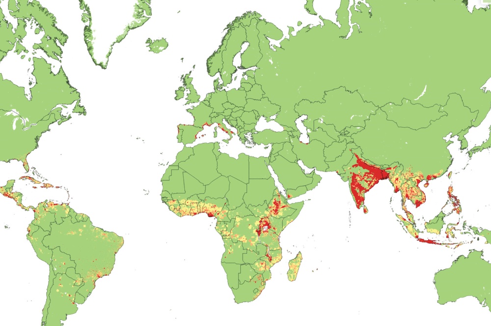
    CHIKRisk: Mapping the Next Chikungunya Outbreak [Image 1 of 3]

    Issued by: on

    VIRIN:
    Date Created:
    City:
    State:
    Country:
    This is a world map using a color gradient (green to yellow to red) to represent varying intensity levels of a measured variable across geographic regions. The highest concentrations (red) are prominently visible in South Asia (particularly India and Bangladesh), parts of Southeast Asia, Central Africa, and portions of Java/Indonesia. The map appears to depict population density, environmental stress, or a similar demographic/geographic metric.

    FORT BELVOIR, VIRGINIA, UNITED STATES

    04.27.2020

    Courtesy Photo

    Defense Threat Reduction Agency's Chemical and Biological Technologies Department

    Past informs the future: scientists leverage historical data to prepare for a future outbreak of the chikungunya virus.

    IMAGE INFO

    Date Taken: 04.27.2020
    Date Posted: 04.27.2020 11:54
    Photo ID: 6189261
    VIRIN: 200427-A-AB123-001
    Resolution: 2083x1385
    Size: 399.02 KB
    Location: FORT BELVOIR, VIRGINIA, US

    Web Views: 204
    Downloads: 5

    PUBLIC DOMAIN




