
(e.g. yourname@email.com)

Forgot Password?

    Digital Visual Information Distribution System Logo

    MC20 Marine Pollution Surveillance Report April 2018 [Image 1 of 5]

    Issued by: on

    VIRIN:
    Date Created:
    City:
    State:
    Country:
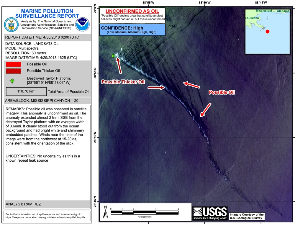
    This is a NOAA Marine Pollution Surveillance Report dated April 30, 2018, analyzing a Landsat 8 OLI satellite image captured on April 29, 2018 at 1625 UTC over Mississippi Canyon Block 20 in the Gulf of Mexico. The report identifies a possible oil slick extending approximately 21 nautical miles SSE from the destroyed Taylor Platform, covering a total area of 110.70 km². The anomaly is classified as unconfirmed oil with high confidence, showing both possible thicker oil near the source and thinner possible oil extending further southeast.

    UNITED STATES

    04.30.2018

    Courtesy Photo

    U.S. Coast Guard Heartland       

    A National Oceanographic and Atmospheric Administration National Environmental Satellite evaluation of the MC20 well site conducted April 30, 2018. The oil platform collapsed after Hurricane Ivan in 2004. (Courtesy photo illustration)

    IMAGE INFO

    Date Taken: 04.30.2018
    Date Posted: 04.23.2020 14:47
    Photo ID: 6185047
    VIRIN: 180430-G-G0108-1001
    Resolution: 8800x6800
    Size: 20.15 MB
    Location: US

    Web Views: 361
    Downloads: 5

    PUBLIC DOMAIN




