
 Subscribe
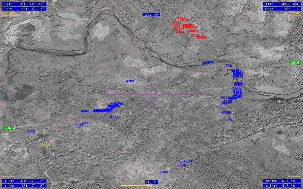
A screenshot provided during Exercise Balikatan 2012, via the Initial-Homestation Instrumentation Training System, tracks the real-time movements of U.S. soldiers from the 100th Battalion, 442nd Infantry, and Philippine Army soldiers with the 50th Infantry Battalion, all annotated in blue, moving to the objective of enemy role players, annotated in red. The I-HITS system ties in with each individual soldier’s Multiple Integrated Laser Engagement Systems and offers performance feedback on various mission sets, giving commanders and trainers the ability to have an instant replay of any training mission, anywhere. Balikatan, a Filipino word meaning “shoulder-to-shoulder,” is an annual bilateral exercise focused on increasing interoperability between the Philippine and U.S. militaries and is being conducted through April 26.
| Date Taken: | 04.20.2012 |
| Date Posted: | 04.23.2012 19:06 |
| Photo ID: | 564055 |
| VIRIN: | 120420-O-XX999-001 |
| Resolution: | 1440x900 |
| Size: | 296.58 KB |
| Location: | FORT MAGSAYSAY, PH |
| Web Views: | 84 |
| Downloads: | 8 |

This work, Training system enhances Balikatan 2012 [Image 3 of 3], by LCpl Kris Daberkoe, identified by DVIDS, must comply with the restrictions shown on https://www.dvidshub.net/about/copyright.


Training system enhances Balikatan 2012
No keywords found.




