
(e.g. yourname@email.com)

Forgot Password?

    Digital Visual Information Distribution System Logo

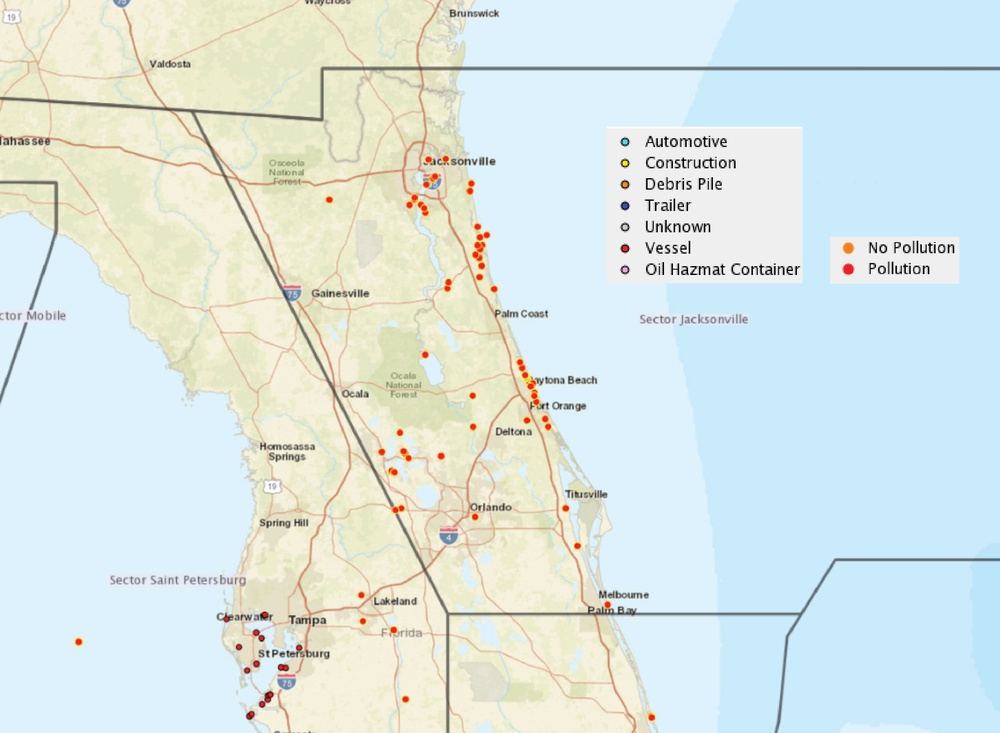
    Response branches for the ESF 10 response to Hurricane Irma [Image 3 of 6]

    Issued by: on

    VIRIN:
    Date Created:
    City:
    State:
    Country:
    This is a geographic map of Florida and surrounding states showing incident or pollution reporting data points. The map uses color-coded markers to distinguish between different types of debris/hazmat objects and whether pollution is present. The highest concentration of markers appears along Florida's eastern coastline and in the Tampa/St. Petersburg area.

    MIAMI, FLORIDA, UNITED STATES

    09.27.2017

    Photo by Petty Officer 1st Class Stephen Lehmann 

    U.S. Coast Guard PIAT NSF

    A National Oceanic and Atmospheric Administration chart displays the geographic area encompassed by the Jacksonville Branch of the ESF 10 response to Hurricane Irma and the points of concern being addressed in that area.

    IMAGE INFO

    Date Taken: 09.27.2017
    Date Posted: 09.29.2017 08:15
    Photo ID: 3820246
    VIRIN: 170928-G-ZZ999-010
    Resolution: 2250x1650
    Size: 1.06 MB
    Location: MIAMI, FLORIDA, US

    Web Views: 85
    Downloads: 5

    PUBLIC DOMAIN




