
(e.g. yourname@email.com)

Forgot Password?

    Digital Visual Information Distribution System Logo

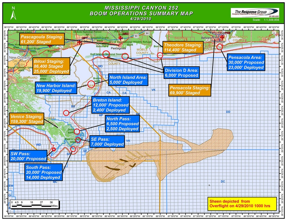
    Graphic Showing the Proposed Shoreline Boom Locations. [Image 1 of 7]

    Issued by: on

    VIRIN:
    Date Created:
    City:
    State:
    Country:
    This is the Mississippi Canyon 252 Boom Operations Summary Map dated 4/29/2010, produced by The Response Group in response to the Deepwater Horizon oil spill. The map shows boom deployment and staging operations across the Gulf Coast from Louisiana to Florida, with an oil sheen depicted from an overflight at 1000 hrs on 4/29/2010. Multiple staging areas and deployment zones are labeled with footage quantities across the affected coastline.

    ROBERT, LOUISIANA, UNITED STATES

    04.29.2010

    Courtesy Photo

    U.S. Coast Guard Atlantic Area

    Graphic showing the proposed shoreline boom locations. (Illustration provided by Unified Command)

    IMAGE INFO

    Date Taken: 04.29.2010
    Date Posted: 05.03.2010 13:59
    Photo ID: 275340
    Resolution: 1024x791
    Size: 741.74 KB
    Location: ROBERT, LOUISIANA, US

    Web Views: 150
    Downloads: 26

    PUBLIC DOMAIN




