
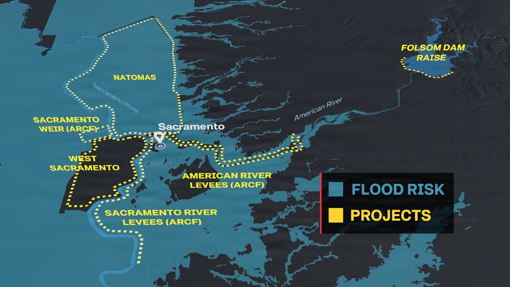
A 3D visualization provides a regional overview of major U.S. Army Corps of Engineers Sacramento District Civil Works projects reducing flood risk across California’s Capital Region. The visualization highlights the Natomas Basin, West Sacramento, American River Common Features and Folsom Dam Raise projects and illustrates how the region’s flood risk management infrastructure works as an interconnected system. (U.S. Army graphic by John Prettyman)
| Date Taken: | 08.17.2026 |
| Published: | 08-17-26 09:18 PM |
| Graphic ID: | 44202 |
| VIRIN: | 260817-A-AN535-1002 |
| Size: | 1.37 MB |
| Location: | SACRAMENTO, CALIFORNIA, US |
| Web Views: | 2 |
| Downloads: | 0 |

This work, Sacramento Region Civil Works Projects 3D Visualization, by John Prettyman, identified by DVIDS, must comply with the restrictions shown on https://www.dvidshub.net/about/copyright.





