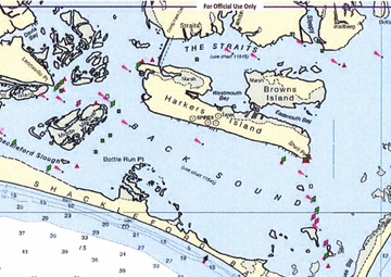
Photo by Petty Officer 2nd Class Edward Wargo | U.S. Coast Guard East District | 11.26.2019
The Coast Guard is seeking input from commercial and recreational mariners for an assessment of navigation requirements in the vicinity of Shackleford Banks and Harker's Island, North Carolina, Nov. 26, 2019. This Coast Guard Waterways Analysis and Management System (WAMS) study focuses on multiple waterways in the area between Beaufort Inlet and Core Sound....
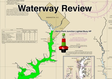
Photo by Petty Officer 1st Class Andrew Kendrick | U.S. Coast Guard East District | 04.02.2019
A graphic illustration of where U.S. Coast Guard Sector Maryland-National Capital Region in Baltimore will be conducting the Waterways Analysis and Management System on the Potomac River throughout the months of April-June. The zone extends from north of the Governor Harry W. Nice/Thomas “Mac” Middleton Bridge (Route 301) to the Hains Point Lighted Buoy HP. (U.S. Coast Guard photo by......
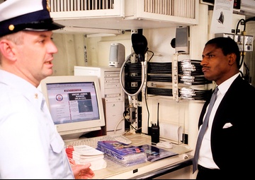
Courtesy Photo | U.S. Coast Guard East District | 04.26.2000
Washington, D.C. (April 26) -- Secretary of Transportation Rodney Slater listens to a U.S. Coast Guard Cutter James Rankin crewman explain the vessel's user-friendly website. Part of the website includes chart where a mariner can click on a location and report a navigation problem or observation. After review, it is then forwarded to Coast Guard's Waterway Analysis Management System (WAMS).......