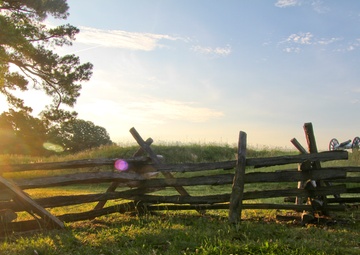
Photo by Patrick Bloodgood | U.S. Army Corps of Engineers, Norfolk District | 06.06.2013
Portions of the Yorktown Revolutionary War battlefield are at risk of being washed away due to erosion of the shoreline along the York River here. The Corps of Engineers is working with the National Park Service to stabilize and repair areas at risk along the river. (U.S. Army photo/Patrick Bloodgood)...
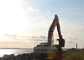
Photo by Patrick Bloodgood | U.S. Army Corps of Engineers, Norfolk District | 06.06.2013
Contractors use rock to stabilize the York River shoreline along 800 feet of the Colonial National Parkway here June 6, 2013. The area is part of more than four miles of shoreline in need of stabilization due to severe erosion, which is threatening portions of the parkway and the National Park Service’s Colonial National Historic Park. (U.S. Army photo/Patrick Bloodgood)...
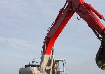
Photo by Patrick Bloodgood | U.S. Army Corps of Engineers, Norfolk District | 06.06.2013
Contractors operating a telescopic crawler crane use rock to stabilize the York River shoreline along 800 feet of the Colonial National Parkway at Yorktown, Va., June 6, 2013. The area is part of more than four miles of shoreline in need of stabilization due to severe erosion, which is threatening portions of the parkway and the National Park Service’s Colonial National Historic Park. (U.S.......