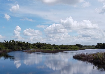
Photo by Brigida Sanchez | U.S. Army Corps of Engineers, Jacksonville District | 07.17.2025
A birds eye view of the Myakka River, the state park is one of Florida's largest and most diverse natural areas. It is one of Florida's oldest parks and was developed by the Civilian Conservation Corps in 1934. In the winter, ducks and shorebirds feed in the shallows as bald eagles and ospreys fish from above. Canopies line the river, wetlands, prairies, hammocks and pinelands. The state park,......
Photo by Spc. Skylin Simpson | 109th Mobile Public Affairs Detachment | 07.16.2025
Fort Indiantown Gap, Pennsylvania, boasts a remarkably diverse range of plant and animal life due to a combination of factors including high-quality habitats, conservation initiatives and forested regions. The Bureau of Environmental Management manages over 17,000 acres of natural resources while working to preserve Fort Indiantown Gaps unique ecosystem, including endangered species and......
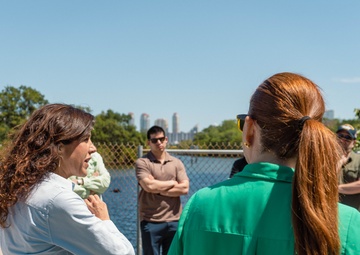
Photo by Jazika Levario | U.S. Army Corps of Engineers, Jacksonville District | 03.21.2025
On March 21, 2025, Carolina Maran, District Resiliency Officer, South Florida Water Management District, briefs the Transportation and Infrastructure subcommittee staff delegates, and partners at S-29 structure in Miami during a portion of the Oversight Field Visit to review operations and maintenance of the Central & Southern Florida (C&SF) flood control project, implementation of the......
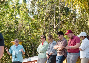
Photo by Jazika Levario | U.S. Army Corps of Engineers, Jacksonville District | 03.21.2025
On March 21, 2025, Craig Grossenbacher, Chief, Water Resources Coordination, Department of Environmental Resource Management, Miami-Dade County, briefs the Transportation and Infrastructure subcommittee staff delegates, and partners at Deering Estates during a portion of the Oversight Field Visit to review operations and maintenance of the Central & Southern Florida (C&SF) flood control......
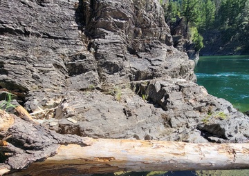
Photo by Nicole Celestine | U.S. Army Corps of Engineers, Seattle District | 10.10.2024
Log pinned against rock wall. Metal tags are located near the root wad or at the end of the log, to track logs' location in the river. This is part of the Army Corps’ Engineering with Nature (EWN) program designed to help improve ecosystem function in the Kootenai River downstream of Libby Dam....
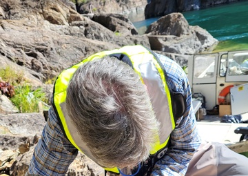
Photo by Nicole Celestine | U.S. Army Corps of Engineers, Seattle District | 10.10.2024
Hydraulic Engineer Zac Corum drills holes into the metal panel of the GPS unit to help increase cellular connection. This is part of the Army Corps’ Engineering with Nature (EWN) program designed to help improve ecosystem function in the Kootenai River downstream of Libby Dam...

Photo by Nicole Celestine | U.S. Army Corps of Engineers, Seattle District | 10.10.2024
The Field Maps app allows users to view existing project data and plot new locations of logs, critical to USACE's Engineering with Nature (EWN) program designed to help improve ecosystem function in the Kootenai River downstream of the dam....
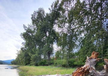
Photo by Nicole Celestine | U.S. Army Corps of Engineers, Seattle District | 10.10.2024
A log deposited on rocky riverbank as part of USACE's Engineering with Nature (EWN) program designed to help improve ecosystem function in the Kootenai River downstream of the dam....