
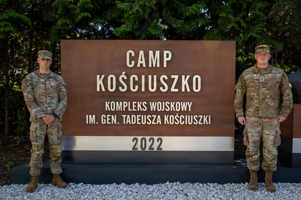
Photo By Spc. Thomas Madrzak | U.S. Army Chief Warrant Officer 2 Joshua Fox, a geospatial engineering technician,...... read more read more
 Subscribe
POZNAŃ, Poland — On a map, the route may look open. On the ground, it may be anything but. Soil can give way beneath heavy vehicles, forests can restrict movement, obstacles can turn the fastest route into the wrong one. A bridge, slope or narrow passage can change where a formation can go and how it gets there.
Before Soldiers ever make that move, someone has to understand what terrain is telling them.
“I analyze terrain and the geospatial effect on the battlefield to aid the commander in his decision-making process,” said U.S. Army Staff Sgt. Zachariah Lang, a 12Y geospatial engineer assigned to V Corps Headquarters (Forward).
Lang, a Covington, Georgia, native approaching 10 years of Army service, entered the career field expecting something much simpler.
“All I knew about 12 Yankees was maybe map making,” Lang said.
He quickly discovered that the map is often only the final product of a larger process.
Army geospatial engineers' main task is to analyze geographic information to aid commanders and staff's understanding on how terrain could influence military operations. Roads, elevation, vegetation, soil, infrastructure and obstacles can all factor into that analysis.
The challenge is not simply identifying where those features are. It is determining what they mean.
A road may connect two locations, but the surrounding terrain can determine whether military vehicles can actually use it. A forest may provide concealment while also restricting movement. The most direct route may not be the most practical once the ground itself is taken into account.
Some days involve responding to straightforward requests for information. During major exercises, operations or planning events, the team may conduct more in-depth analysis to help staff develop courses of action.
Lang pointed to a combined obstacle overlay as one example. The analysis can bring together information such as slope, soil, vegetation, and transportation routes to help planners understand how terrain may affect movement.
“It’s all about exploiting the terrain,” Lang said. “That’s where we provide that analysis, so the commander can basically decide, ‘Okay, we’re going to send this column this way,’ or ‘I agree with this course of action,’ or ‘I do not agree with this course of action.’”
Before the team can produce and answer, they first have to understand the requirement.
U.S, Army Chief Warrant Officer 2 Joshua Fox, a 125D geospatial engineering technician, assigned to V Corps Headquarters (Forward), helps connect those requirements with the Soldiers conducting the analysis.
Fox began his career as an enlisted 12Y after earning a degree in geography. He later transitioned to the warrant officer corps, where his responsibilities shifted toward overseeing geospatial production and integrating the team's capabilities with the broader staff.
A requester may understand the problem that needs to be solved without knowing which geospatial product or analysis will best answer it.
“The customer doesn’t necessarily know what we do and how we do it,” Fox said. “So, our job is to kind of guide them and give them something efficient for what they need.”
That means more information isn't always better.
A product can contain accurate data and still be inadequate for the commander or staff, who can’t quickly understand what matters or applies. Fox explains that geospatial professionals have to learn how their customers absorb information and present it in a way that supports the decision-making process.
For Lang, experience has brought greater responsibility, but it has not removed him from the technical side of the job. He remains involved in producing and reviewing geospatial products while also serving as a noncommissioned officer.
Experience also does not remove the need for another set of eyes.
A product may take hours to build and draw information from multiple sources. Before it is released, Lang said teammates routinely review one another's work to catch errors and make sure the information is understandable.
“We always have to get a second or third pair of eyes to look at our product,” Lang said. “It’s just an extra layer of safety, making sure that our data is correct.”
Fox emphasizes that level of attention matters.
“It’s a lot of attention to detail and ensuring that your information is good and your information is as accurate as possible,”
The work demands patience as much as technical ability.
Lang described successful geospatial engineers as analytical problem solvers who can accept criticism and revise their work. Fox emphasized persistence, adaptability and willingness to continue learning.
He also offered a less formal requirement.
“They should love staring at a computer for a few hours watching data load,” Fox said.
Behind the joke is a profession where a process may fail, data may not behave as expected and an analysis may need to be approached from another direction.
“You’re going to hit so many dead ends trying to accomplish something, and it’s not going to work,” Fox said. “The whole point is to not stop what you’re trying to do and find other workarounds.”
That persistence becomes most visible after the work leaves the geospatial section.
“We sometimes spend hours and hours and hours on one product at a time,” Lang said.
Then the staff begins using it.
Routes are discussed. Courses of action begin taking shape. Leaders reference information the geospatial team collected, analyzed and presented.
For Lang, that is when the hours behind the screen become tangible.
“The most pride you experience … is when you’re briefing that product,” Lang said. “You know, ‘Hey, I know my stuff. I’m helping the team and making a difference.’”
Yet both Lang and Fox said one of the career field’s biggest challenges is convincing others that geospatial engineers do more than produce maps.
“Most people just assume map making,” Fox said. “We have a big printer. We print maps. That’s all, to them, what they know.”
Behind that map are the questions, analysis, passion and hours of work used to help a staff understand what the terrain could mean for a mission.
Lang believes that capability remains underrecognized across the Army.
“If commanders actually understood more of what our capabilities were,” Lang said, “I feel like they would have a serious wild card.”
| Date Taken: | 08.11.2026 |
| Date Posted: | 08.17.2026 07:06 |
| Story ID: | 572519 |
| Location: | POZNAN, PL |
| Web Views: | 28 |
| Downloads: | 0 |

This work, Before the move: V Corps geospatial engineers turn terrain into decisions, by SPC Thomas Madrzak, identified by DVIDS, must comply with the restrictions shown on https://www.dvidshub.net/about/copyright.

No keywords found.




