
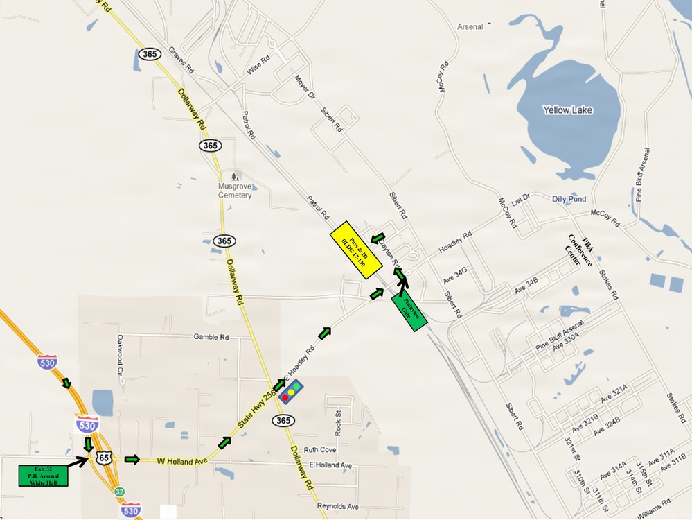
A directional map displays the route to Pine Bluff Arsenal (PBA) near Pine Bluff, Ark., with green arrows indicating the approach from Interstate 530 via Exit 32 and U.S. Highway 65 northbound. The map highlights two destination buildings — a yellow-marked Police/BLDG structure and a green-marked Finance Center — accessible via Dollarway Road and State Highway 256/365. Yellow Lake and the PBA Conference Center are visible landmarks on the installation's eastern side. The route traverses through the White Hall area before entering the arsenal grounds.
| Date Taken: | 08.31.2026 |
| Date Posted: | 08.31.2026 14:51 |
| Photo ID: | 9901460 |
| VIRIN: | 260831-A-YZ466-2900 |
| Resolution: | 3302x2478 |
| Size: | 878.93 KB |
| Location: | US |
| Web Views: | 6 |
| Downloads: | 0 |

This work, Pine Bluff Arsenal Directional Map Showing Route from Interstate 530 to Installation, by Dori Whipple, identified by DVIDS, must comply with the restrictions shown on https://www.dvidshub.net/about/copyright.





