
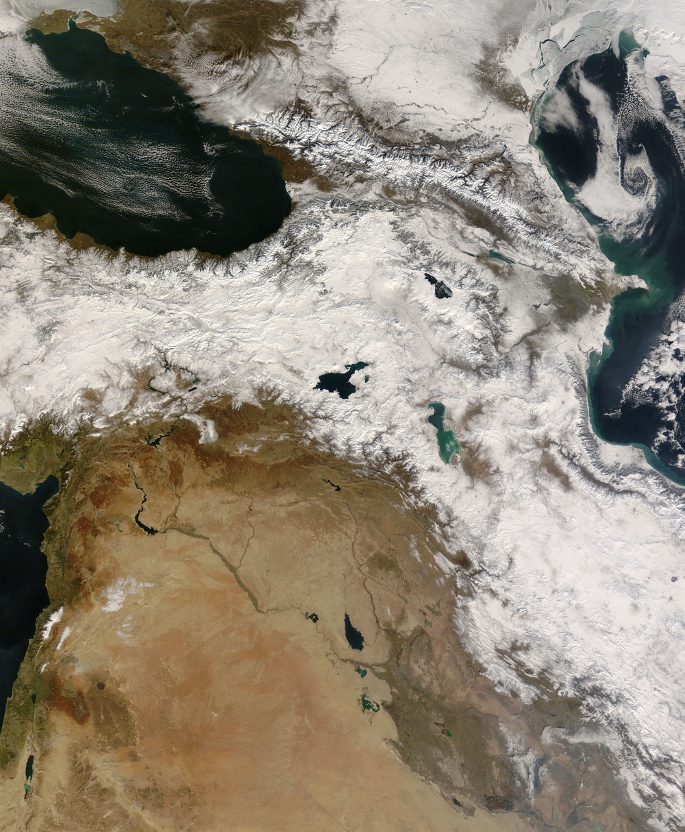
Winter settled heavily over Southwest Asia in January 2008. Intense cold and moist air combined to bring rare or unusually heavy snow to earthobservatory.nasa.gov/NaturalHazards/natural_hazards_v2.php3?img_id=14693&src=map Iraq and earthobservatory.nasa.gov/NaturalHazards/natural_hazards_v2.php3?img_id=14683 Iran. Snow arcs from Iran to Turkey in this photo-like image captured by the Moderate Resolution Imaging Spectroradiometer ( modis.gsfc.nasa.gov MODIS ) on NASA's terra.nasa.gov/ Terra satellite on January 15, 2008. AccuWeather reported that bitterly cold air over central Asia caused''sea-effect''snow along the southwestern shores of the Caspian Sea (top right). The cold air moved over the Caspian Sea, picking up moisture, which fell as snow over the mountains of eastern Iran and Azerbaijan. Since the southern shore of the Black Sea (top left) is also snowier than its northern shore, some of this snow may be sea-effect snow as well.
The wintry weather pattern brought snow or rain to much of the Middle East. Though the continuous band of snow does not extend farther south than northern Iraq in this image, a dusting of snow covers the mountains of Lebanon and parts of the Syrian Desert. Red dots mark the location of fires or gas flares.
The large image provided above has a resolution of 250 meters per pixel, MODIS' maximum resolution. The image is available in rapidfire.sci.gsfc.nasa.gov/gallery/?2008015-0115/Turkey.A2008015.0810.2km.jpg additional resolutions from the MODIS Rapid Response System.
NASA image courtesy Jeff Schmaltz, rapidfire.sci.gsfc.nasa.gov/ MODIS Rapid Response Team at NASA GSFC. Caption by Holli Riebeek.
| Date Taken: | 08.02.2011 |
| Date Posted: | 02.08.2013 22:53 |
| Photo ID: | 861288 |
| Resolution: | 5600x6800 |
| Size: | 6.97 MB |
| Location: | WASHINGTON, D.C., US |
| Web Views: | 29 |
| Downloads: | 1 |






