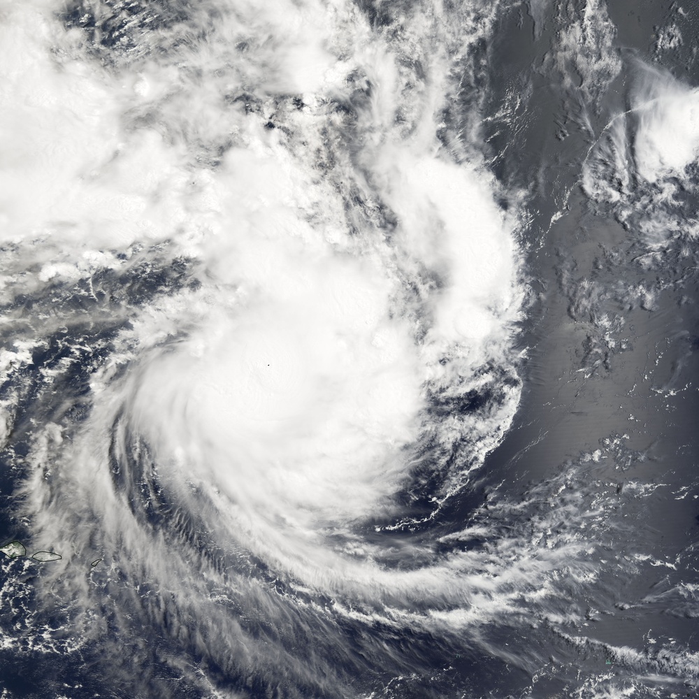
On February 27, 2005, Tropical Cyclone Percy continued to gather steam as it struck Swain's Island, a tiny island in American Samoa. Tropical Cyclone Percy is the fourth large cyclone to sweep across the South Pacific in as many weeks, and at the time this image was taken at 10:05 a.m., local time, the storm was the equivalent of a Category 3 Hurricane with winds of 195 kilometers per hour (121 mph) and gusts to 240 kph (150 mph). By March 1, Percy would reach Category 4 status on the Saffir-Simpson Hurricane Scale, with winds of 213 kph (132 mph) and gusts to 260 kph (161 mph). The Moderate Resolution Imaging Spectroradiometer ( modis.gsfc.nasa.gov MODIS ) on NASA's terra.nasa.gov/ Terra satellite captured this true-color image of the storm on February 27.
NASA image created by Jesse Allen, Earth Observatory, using data obtained from the Goddard DAAC.
| Date Taken: | 07.26.2011 |
| Date Posted: | 02.08.2013 16:16 |
| Photo ID: | 853038 |
| Resolution: | 6850x6850 |
| Size: | 3.8 MB |
| Location: | WASHINGTON, D.C., US |
| Web Views: | 6 |
| Downloads: | 2 |
