
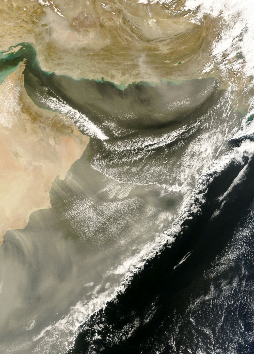
A weather forecast for the United Arab Emirates (UAE) on January 31, 2008, called for high winds and the possibility of dust storms. Two days later, the predictions came to pass -- with a vengeance. The Moderate Resolution Imaging Spectroradiometer modis.gsfc.nasa.gov (MODIS) on NASA's terra.nasa.gov Terra satellite captured this image of Oman, UAE, Iran, Pakistan, the Gulf of Oman, and the Arabian Sea. This image shows thick dust plumes, bordered by thick banks of clouds, blowing over the ocean waters.
Vast sand seas cover much of the Arabian Peninsula, and smaller pockets of sand occupy Iran and Pakistan. This picture shows dust plumes blowing southward from Iran and Pakistan, fanning out over the Gulf of Oman. Farther south, a massive cloud of dust stretches over the Arabian Sea. Although some dust plumes appear to originate near the southeastern coast of Oman, much of the dust likely originates farther inland on the peninsula.
You can download a eoimages.gsfc.nasa.gov/images/imagerecords/19000/19612/ArabianSea.A2008033.0620.250m.kmz 250-meter-resolution KMZ file of the dust storm suitable for use with earth.google.com/ Google Earth.
NASA image courtesy Jeff Schmaltz, rapidfire.sci.gsfc.nasa.gov MODIS Land Rapid Response Team at NASA GSFC. Caption by Michon Scott.
| Date Taken: | 08.03.2011 |
| Date Posted: | 02.08.2013 12:42 |
| Photo ID: | 847917 |
| Resolution: | 5600x7800 |
| Size: | 6.54 MB |
| Location: | WASHINGTON, D.C., US |
| Web Views: | 23 |
| Downloads: | 1 |






