
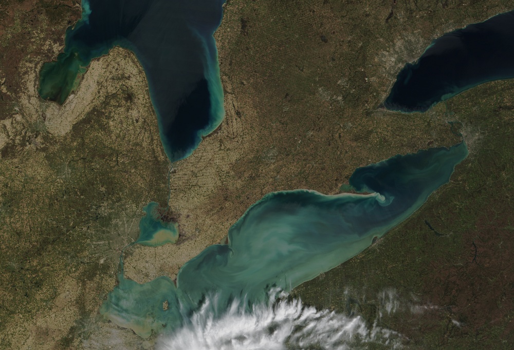
A ''whiting event'' was ongoing in Lake Erie in late April and early May 2002. The bright turquoise color of Erie's surface waters is probably caused by elevated levels of calcium carbonate (basically chalk) sediment in the water. Lake Erie generally has a lot of calcium carbonate in it because the floor of the lake is limestone. During most of the year the calcium carbonate remains dissolved in the cold water, but as the lake warms up, the solubility of calcium carbonate is lowered. As a result, the calcium carbonate precipitates out of the water, forming clouds of very small solid particles that appear as bright swirls from above.
This true-color image was acquired by the modarch.gsfc.nasa.gov/ Moderate-resolution Imaging Spectroradiometer (MODIS), flying aboard NASA's terra.nasa.gov/ Terra satellite, on May 4, 2002.
Image courtesy Jacques Descloitres, rapidfire.sci.gsfc.nasa.gov/ MODIS Land Rapid Response Team at NASA GSFC
| Date Taken: | 07.21.2011 |
| Date Posted: | 02.08.2013 10:24 |
| Photo ID: | 844415 |
| Resolution: | 1998x1362 |
| Size: | 1.99 MB |
| Location: | WASHINGTON, D.C., US |
| Web Views: | 48 |
| Downloads: | 3 |






