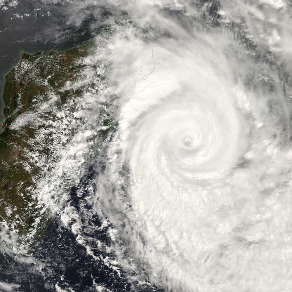
Tropical Cyclone Gamede was in the western Indian Ocean off the shore of Madagascar on February 26, 2007. This powerful storm had been moving southward parallel to the eastern coast of Madagascar for two days at this time, bringing heavy rains and strong surf to Madagascar and the two major Mascarene Islands, Reunion and Mauritius. The storm seemed to be staying away from settled areas, but reports from the https://metocph.nmci.navy.mil/jtwc.php Joint Typhoon Warning Center and ukie.accuweather.com/ U.K. Accuweather noted strong surf on the coast and island shorelines, as well as heavy rain. This same area was brushed by /NaturalHazards/natural_hazards_v2.php3?img_id=14136 Cyclone Favio just days before, and it suffered a series of severe storms and cyclones in preceding months. Unlike Favio, Gamede was predicted to continue on its generally southward track and not turn towards mainland Africa.
This photo-like image was acquired by the Moderate Resolution Imaging Spectroradiometer modis.gsfc.nasa.gov/ (MODIS) on the aqua.nasa.gov/ Aqua satellite on February 26, 2007, at 11:50 a.m. local time (9:50 UTC). The storm was a mature and powerful tropical cyclone, with a well-defined eye at its center and far-reaching, tightly wound spiral arms. According to the University of Hawaii's www.solar.ifa.hawaii.edu/Tropical/ Tropical Storm Information Center, Cylone Gamede has sustained winds of 175 kilometers per hour (110 miles per hour) around the eyewall at the time this image was acquired. Forecasts at the time called for the storm to avoid landfall, but to continue its grazing path between the Mascarene Islands and Madagascar, with winds continuing to intensify as the storm traveled south over warm waters.
NASA image by Jesse Allen, using data provided courtesy of the rapidfire.sci.gsfc.nasa.gov MODIS Rapid Response Team, Goddard Space Flight Center.
| Date Taken: | 08.01.2011 |
| Date Posted: | 10.19.2012 14:30 |
| Photo ID: | 748112 |
| Resolution: | 6000x6000 |
| Size: | 4.45 MB |
| Location: | WASHINGTON, DISTRICT OF COLUMBIA, US |
| Web Views: | 24 |
| Downloads: | 0 |
