
 Subscribe
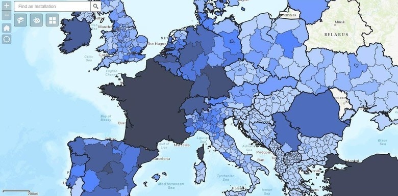
The GeoBase Team from the Air Force Installation and Mission Support Center’s Detachment 4 at Ramstein Air Base, Germany developed the The Air Force’s COVID-19 dashboard specifically for U.S. Air Forces in Europe and Air Forces Africa. The cascading shades of color over the regions represent the number of reported COVID-19 cases based on established categories. The GeoBase Team packaged two other tools with the dashboard – GeoPDF and the COVID-19 map viewer. (Courtesy Image)
| Date Taken: | 04.15.2020 |
| Date Posted: | 05.21.2020 04:18 |
| Photo ID: | 6217431 |
| VIRIN: | 200415-F-F3406-0001 |
| Resolution: | 780x385 |
| Size: | 98.21 KB |
| Location: | RAMSTEIN AIR BASE, RHEINLAND-PFALZ, DE |
| Web Views: | 70 |
| Downloads: | 2 |

This work, COVID-19 ops: Det 4 expands USAFE-AFAFRICA capabilities, by TSgt Milton Hamilton, identified by DVIDS, must comply with the restrictions shown on https://www.dvidshub.net/about/copyright.




