(e.g. yourname@email.com)

Forgot Password?

    Digital Visual Information Distribution System Logo

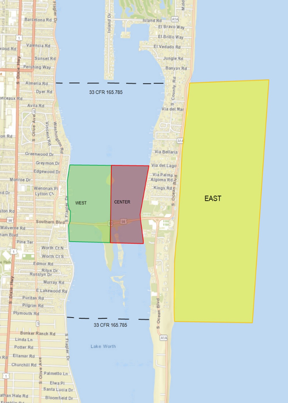
    Mar A Lago Security Zones

    Issued by: on

    VIRIN:
    Date Created:
    City:
    State:
    Country:
    This is a nautical/regulatory map of the Lake Worth Lagoon area near West Palm Beach, Florida, showing three designated zones labeled WEST (green), CENTER (red/purple), and EAST (yellow). The map includes dashed boundary lines marked '33 CFR 165.785', indicating U.S. Coast Guard regulated navigation zones. The area spans from the mainland on the west side through the Intracoastal Waterway to the Atlantic Ocean on the east side.

    MAR A LAGO, FLORIDA, UNITED STATES

    11.26.2019

    Courtesy Photo

    U.S. Coast Guard Southeast     

    Security Zones in vicinity of Mar A Lago, Florida are established during VIP visits to the Miami area. U.S. Coast Guard illustration courtesy of Sector Miami

    IMAGE INFO

    Date Taken: 11.26.2019
    Date Posted: 11.26.2019 14:24
    Photo ID: 5940501
    VIRIN: 191126-G-G0107-1005
    Resolution: 1500x2100
    Size: 809.52 KB
    Location: MAR A LAGO, FLORIDA, US

    Web Views: 1,808
    Downloads: 3

    PUBLIC DOMAIN