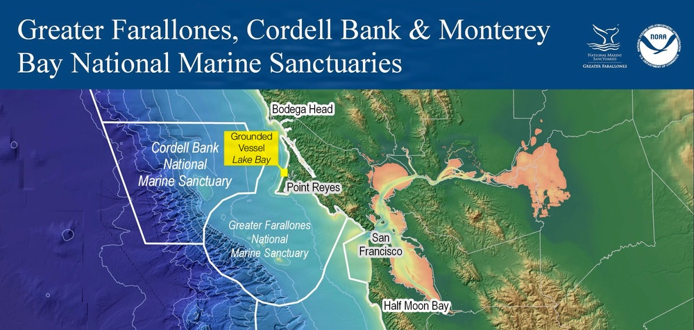
A graphic depicts the approximate geographic location of grounded fishing vessel Lake Bay at Point Reyes North Beach, California, Aug. 28, 2026. A unified command was established to respond to the incident as a pollution threat on the border between Point Reyes National Seashore and the Greater Farallones National Marine Sanctuary. (NOAA graphic. Note: This graphic was modified by USCG to include a location label and cropped for clarity, Original: https://nmsfarallones.blob.core.windows.net/farallones-prod/media/maps/three_sanctuary_vertical_map.jpg )

 Subscribe





