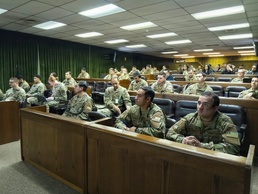
SANTIAGO, Chile— Soldiers from U.S. Army Western Hemisphere Command’s 512th Engineer Detachment Geospatial Planning Cell, G-37 Engineer Directorate, and G-2 Intelligence Directorate, conducted a Geospatial Tactical Workshop and Subject Matter Expert Exchange Sept. 1-3 at the Instituto Geográfico Militar in Santiago, Chile, as part of a bilateral engagement with the Chilean Army.
The workshop supported agreements established during the 20th Bilateral Army Staff Meeting between the U.S. and Chilean armies in 2025.
During the three-day engagement, participants focused on strengthening partner capacity in geospatial engineering, improving integrated capabilities for geospatial data acquisition, building an enduring framework for collaboration, knowledge sharing, and innovation between the two armies.The exchange also supported the broader goal of reinforcing the partnership between USAWHC and the Chilean Army through the sharing of current tactical geospatial processes, increased interoperability, and a deeper mutual understanding of geospatial capabilities.
“Workshops like this are essential to strengthening interoperability and building a shared understanding of how geospatial engineering and geographic information system capabilities support operations at both the operational and tactical levels,” said Maj. Alfredo Carrillo, officer in charge of the 512th Engineer Detachment Geospatial Planning Cell. “By bringing together geospatial experts from the Chilean Army and the Instituto Geográfico Militar, we are able to share knowledge, better understand each other’s capabilities, and identify opportunities to better integrate our geospatial efforts. Ultimately, these exchanges strengthen partner capacity and help ensure we are better prepared to operate together across the Western Hemisphere.”
Throughout the exchange, participants explored ways to improve interoperability, expand knowledge sharing, and develop integrated solutions using geospatial assets. Discussions also included tactics, techniques, and procedures for unmanned aircraft systems reporting and visualization, request-for-information processes, and data collection methods using both unmanned aircraft systems and ground-based collection.
The event concluded with a shared commitment to future geospatial integration, sustained collaboration, continued innovation, and ongoing exchanges that will further strengthen interoperability between the U.S. and Chilean armies.