Learning an advanced reconnaissance survey system isn’t like learning how to ride a bike.
“Surveying is a skill set that is perishable,” said Product Director Combat Terrain Information Systems (PD CTIS) Surveyor and Trainer Natalie Martinez-Vega. “If you don't use it, you totally lose it.”
Martinez-Vega has trained over 300 Army engineers over past seven years – most of them with the Army National Guard – on the Global Positioning System – Survey (GPS-S), a PD-CTIS-fielded system.
“They may have different experience levels and may have not touched the gear or done a survey in a long time,” Martinez-Vega said.
GPS-S is the Army’s survey grade GPS-enabled Positioning, Navigation and Timing (PNT) system that provides sub-centimeter accuracy, precision measurements that enable construction and hydrographic survey operations. The system is critical for Army technical engineers and Army divers, enabling them to develop accurate position location and surface profiles to support planning and analysis for maneuver forces.
PD CTIS Product Director Cory Baron explained the importance of the training for Army engineers.
“Providing responsive, real-world operator training of commercial state-of-the-art technologies using industry standard processes is a critical factor in maintaining technical proficiency to meet mission needs in any environment, anywhere in the world,” said Baron.
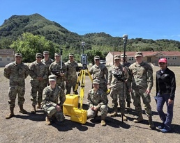
Often joined by PD-CTIS trainer Matt Staley, Martinez-Vega adjusts training plans based on the skill sets of the engineers, many of whom are in the National Guard and may not have recently worked with GPS-S. Training typically consists of classroom time and then several days when engineers apply the new knowledge using GPS-S to survey different terrains.
“Every single student must go out and do surveying on their own,” Martinez-Vega said. “Why? Because it gives them the ability to do hands-on work with the system and to get used its functionality.”
Martinez-Vega said she teaches engineers how to identify errors when using GPS-S and whether the data from satellites is correct to ensure quality and accuracy.
Specialist Raul Garcia-Maanzo with the 579th Engineer Battalion in California recently took a training course led by Martinez-Vega that provided critical systems information and tailored engineering exercises.
“The step by step training with slides helped me out a lot as the one taking the course,” said Garcia. “The explanations of what something means and what it’s used for helped when I was taking points in the field.”
Technical experts also see the benefit of the GPS-S training.
Chief Warrant Officer William Odell with the 416th Theater Engineer Command Army Reserve Unit in Wisconsin recently coordinated with Martinez-Vega on training Army engineers at the Army Geospatial Center.
“All feedback I have heard from Soldiers has been nothing but positive and the desire for more training,” said Odell. “We look forward to continuing partnering with Natalie, Matt, and the Army Geospatial Center for future training.”