WHO: U.S. Army Corps of Engineers (USACE) Pittsburgh District and Southwestern Pennsylvania Commission (SPC)
WHAT: USACE and SPC will co-host multiple open house-style meetings for the public to learn about the progress and early considerations of the Chartiers Creek feasibility study. Representatives from USACE and SPC will be available at stations to answer questions about the study, discuss proposed risk-reduction measures, and collect community feedback on the study’s direction. The meetings do not have a formal agenda; attendees may arrive at any time during the meeting windows.
The study integrates the Army Civil Works' new R.A.P.I.D. framework – Risk-informed, Aligned, Proportional, Iterative, and Decisive – into its planning process to ensure a timely and efficient execution. R.A.P.I.D. is one of the cornerstones of the "Building Infrastructure, Not Paperwork" policy initiative launched in February 2026 by Mr. Adam Telle, Assistant Secretary of the Army for Civil Works.
WHERE: July 14: Canonsburg Borough Building, 68 East Pike Street, Canonsburg, PA 15317
July 15: Carnegie Borough Building, 1 Veterans Way, Carnegie, PA 15106
July 16: McKees Rocks Borough Building, 340 Bell Avenue, McKees Rocks, PA 15136
WHEN: USACE and SPC will host two meetings per day, from 1:30-3:30 p.m. and 5-7 p.m., at each day’s location. The public can submit comments in person at any meeting, by visiting http://www.lrd.usace.army.mil/Missions/Planning/Display/Article/4498576/chartiers-creek-study/, or via email to mailto:celrp.chartiers.creek.gi@usace.army.mil.
MEDIA AVAILABILITY: USACE representatives will be available for interviews during the July 14 meeting from 1:30-3:30 p.m.
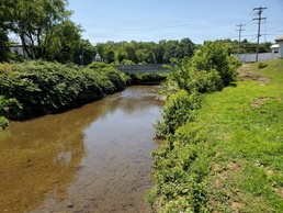
WHY: Chartiers Creek extends 48 miles from Washington County downstream to the Ohio River. In recent decades, the creek’s watershed has experienced frequent flooding, increasing flood- and life-safety risks to communities. The feasibility study is examining the approximately 277 square-mile area to evaluate possible flood risk management solutions and alternatives to reduce risk for the more than 250,000 residents living within the watershed.
Public input is vital to informing the study’s continuing development and ensuring the study is conducted efficiently. Comments will be considered for implementation and future study phases.
BACKGROUND: The Chartiers Creek Watershed Flood Risk Management General Investigation was authorized through WRDA 2022, Section 8021(a)(78). The study was fully-federally funded as part of the Disaster Relief Supplemental Appropriation Act of 2025.
Pittsburgh District’s 26,000 square miles include portions of western Pennsylvania, northern West Virginia, eastern Ohio, western Maryland, and southwestern New York. It includes more than 328 miles of navigable waterways, 22 navigation locks and dams, 16 multi-purpose flood-control reservoirs, 80+ local flood-protection projects, and other projects to protect and enhance the nation’s water resources infrastructure and environment.
Visit us on https://www.facebook.com/PittsburghUSACE/, https://www.instagram.com/PittsburghUSACE , DVIDS, and our website.