It is hard to escape the dull drone of morning traffic on I-75, humming alongside the orchestral chirps of invertebrates shaking the morning dew off their tiny exoskeletons. The tall grasses glisten as the sun is softly diffused through a slowly evaporating fog.
Nature has its own time.
This statement holds true across the 55,000-acre area now known as Picayune Strand Restoration Project, located in Southwest Florida, just east of Ft. Myers and north of the Fakahatchee Strand Preserve State Park.
This large parcel of land—once abundant with cypress domes, pine flatwoods, wet prairies, and swamp forests—fell prey to "conman" developers in the late 1950s.
The land was stripped, canalized, and sold. The fraud was committed by the Gulf American Land Corp.
"They built roads and dug canals so they could set up five-acre plots, and they drained the place," said Michael Duever, an ecologist and consultant for the South Florida Water Management District, as he drove me along unimproved roads that were once asphalt.
The developers paid approximately $100 and made an estimated $900 per acre. They named the development "Southern Golden Gate Estates."
According to Duever, "The canals did their job too well; they didn’t just drain the homesites, they sucked the life out of the region."
Eventually, the law caught up with the fraudulent actions of Gulf American Land Corp. While the development had a few residents, much of the land was left uninhabited.
However, the land had to be acquired before it could be restored. By the 1980s and 1990s, the state began buying back thousands of individual parcels. The process was painstaking. According to Duever, the Conservancy of Southwest Florida worked hard to speed up the acquisition process.
“At first, they filled out the forms by hand, then they used electric typewriters, and as time passed, new interns brought new ideas—like the use of a computer”, said Duever.
Duever pointed toward a space between two pine flatwoods where yellow and orange grasses, dried by the harsh winter, filled the corridor like a prickly carpet.
These "tramways" were once used for logging cypress trees from the wetlands. There were 285 miles of roads and 48 miles of canals; the canals acted as a speedway for water drainage. The spoils were piled alongside the canals, and the developers raised the road, features that mimicked levees and eliminated natural sheet flow.
The Restoration Strategy
The U.S. Army Corps of Engineers and it’s partners could not return the natural flow of water exactly to the way it was before Picayune Strand was developed, but federal, state, local, and non-governmental partners worked together to restore flow throughout the 55,000 acres of wetlands.
The water that cycles through these wetlands is critical to the health of the Everglades.
I asked Duever how one restores such a large swath of land. He replied, "The area was too big to restore at once, so we had to break it down into four phases." He explained that the team had to consider many factors, especially hydrology. They had to balance how much water the wetlands needed to thrive without flooding the people living in surrounding areas.
"We got rid of 270 miles of roads, 60 miles of logging trails, and around 42 miles of canals—and built three massive pump stations to manage flooding and redirect water into the strand," said Duever.
The goal was to recreate “sheet flow,” where water moves slowly in a shallow layer across the flat landscape instead of swiftly through canals. This allows nature to reestablish itself as hydrology is restored, slowly rehydrating the land and letting the natural seeding process take effect. Filling this ecological gap allows key species—such as the Florida panther and black bear—to foraging habitat. Wading birds and other indicator species also proliferate in this restored habitat.
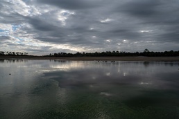
I spent time walking through the strand alone. Because winters are extremely dry, I could venture out into the spreader basin where birds gathered. In the distance, I saw a bevy of deer moving slowly across the mud and into the wet pine forest. While the view through my lens shows a land slowly healing, what I couldn’t see is an ecosystem that remains vulnerable.
“When we restore land, we also have to consider how those changes may allow for invasive and nuisance species,” says Ian Markovich, a biologist with the U.S. Army Corps of Engineers. “When we restore an ecosystem, we turn over the land and sometimes close off man-made water systems, which can leave them vulnerable to invasive species.”
The USACE Invasives Team and its partners continue to manage these species. This includes plants like cabbage palms, melaleuca, Brazilian pepper and invasive grasses; animals like boas, pythons, and monitors; and fish such as tilapia, walking catfish, and oscars.
Duever explained, “Picayune Strand is essential; it is the hydrological and ecological connection to the southwestern portion of the Everglades.” Connecting public lands allows for the movement of water, seeds, and animals. Managing invasives throughout this process is critical to ensuring we connect healthy ecosystems to one another.
In the early morning, I found a place where I could see the sunrise above the misty land that was compromised and abandoned for so long. I could not help but feel a sense of hope; progress is slow, and there are so many people who worked hard to get to this point—from Duever to the next generation, like biologist Markovich, who will continue to help our lands recover. Picayune Strand is just one more piece moving us closer to a healthy and thriving Everglades, which is crucial for the plants, animals, and the humans who live, work, and play there.
Thank you: Mike Duever, Samuel Hans and Ian Markovich