For Geospatial Engineers with the 543rd Engineer Detachment, U.S. Army North, the busiest part of any new mission comes at the beginning stages, and when the Department of Homeland Security requested the Department of Defense to provide a range of assistance to secure the border from Texas to California, the 543rd EN Det. began their part of the Border Support mission by analyzing maps and refining data to paint a picture of the operating areas for commanders and decision-makers to better visualize their areas of operations.
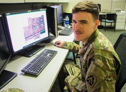
“A lot of the work-up before this mission was to gather information, making connections with Border Patrol and units that are going forward and what their plans and orders are and what they needed to see,” said Sgt. Andrew S. Henn, geospatial engineer, 543rd EN Det. “Then, we take digital data points, lines, polygons, pictures and elevation data and we make a map out of it or decision aid so that people can understand what's going on within the operating area.”
With a vast amount of space to be covered it was important for leaders to understand what type of terrain they would be working in.
“We get questions about what's the terrain like in this area and is the slope going to be an issue,” said Henn. “We get elevation data, run our tools on it and we can determine if this area is going to be severely restricted just based on the slope alone and on this other area you got a river running through it but then right here, this is a spot where that should be fairly easy going and help show where things happen. It helps commanders, decision-makers, visualize their space without having to go there.”
With efforts to harden points of entries along the border and reinforcing the fence line from Texas to California the information the geospatial engineers have provided has had a direct impact to the mission.
“The products provided from the geospatial team greatly increased our ability to integrate with our partners and begin making assessments upon arrival,” said Lt. Col. Brad Morgan, 19th Engineer Battalion. “We were able to understand the terrain coming in, what our challenges would be and then work with our federal partners to plan out where the barriers would be emplaced to better fortify the port of entry locations.”
1st Lt. Christopher R. Esposito, Executive Officer for the 543rd EN Det., explained the impact his Soldiers have had on the mission.
“It helped the Engineer directorate better compile their assessment say ‘Here's where we need to put the wall,’ because our guys did the leg work,” said Esposito. “It provided the most up to date image without having to be on the ground yourself.”
As the Border Support mission goes on, the geospatial engineers continue to diligently provide the most up to date picture for service members working to secure the border and support the Department of Homeland Security and U.S. Customs and Border Protection as needed.