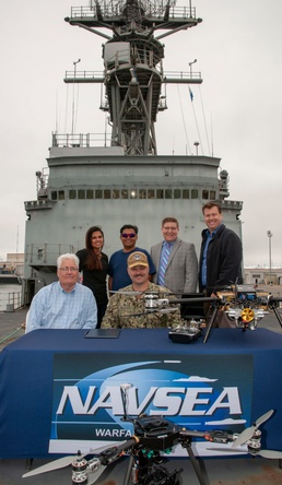
Naval Surface Warfare Center, Port Hueneme Division (NSWC PHD) is collaborating with industry partner Aerial Alchemy to research and investigate the use of unmanned aerial systems to enhance maintenance and fleet readiness for the U.S. Navy.
Specifically, the unmanned systems are capable of visually capturing the exterior surface of naval ships. This data could then be used to develop 3D digital models with the end goal of identifying damage, corrosion, and alignment issues.
“Collaboration is key to rapidly increasing the lethality of our Navy,” said NSWC PHD Commanding Officer, Capt. Ray Acevedo. “Industry and academia are on the cutting edge of technology and are able to quickly advance these systems, allowing us to provide critical capabilities to the fleet.”
Representatives of NSWC PHD and Aerial Alchemy formalized partnership efforts through a Cooperative Research and Development Agreement (CRADA).
The CRADA is part of NSWC PHD’s ongoing Naval Innovative Science and Engineering research focused on innovative technologies and solutions designed to advance the future of in-service engineering. The Federal Technology Transfer Act of 1986 allows warfare centers and research laboratories to collaborate with industry and academic in research, engineering and technology development.
“Our ability as in-service engineers to support the fleet currently requires extensive on-site personnel in order to identify configuration, damage, corrosion, and other mechanical issues,” said Alan Jaeger, NSWC PHD Office of Research and Technology Applications manager. “The concept of a ‘digital twin’ or as-built models of surface ships provides extensive opportunities to better serve the fleet.”
Aerial Alchemy is a mission-based remote data capture and delivery company which designs and builds purpose-built, modular commercial drone-based solutions developed on open standards. Through the transformation of various types of oblique and multi-dimensional data into high-quality 3D models, they provide unique data to civil and environmental infrastructure and ecological projects.