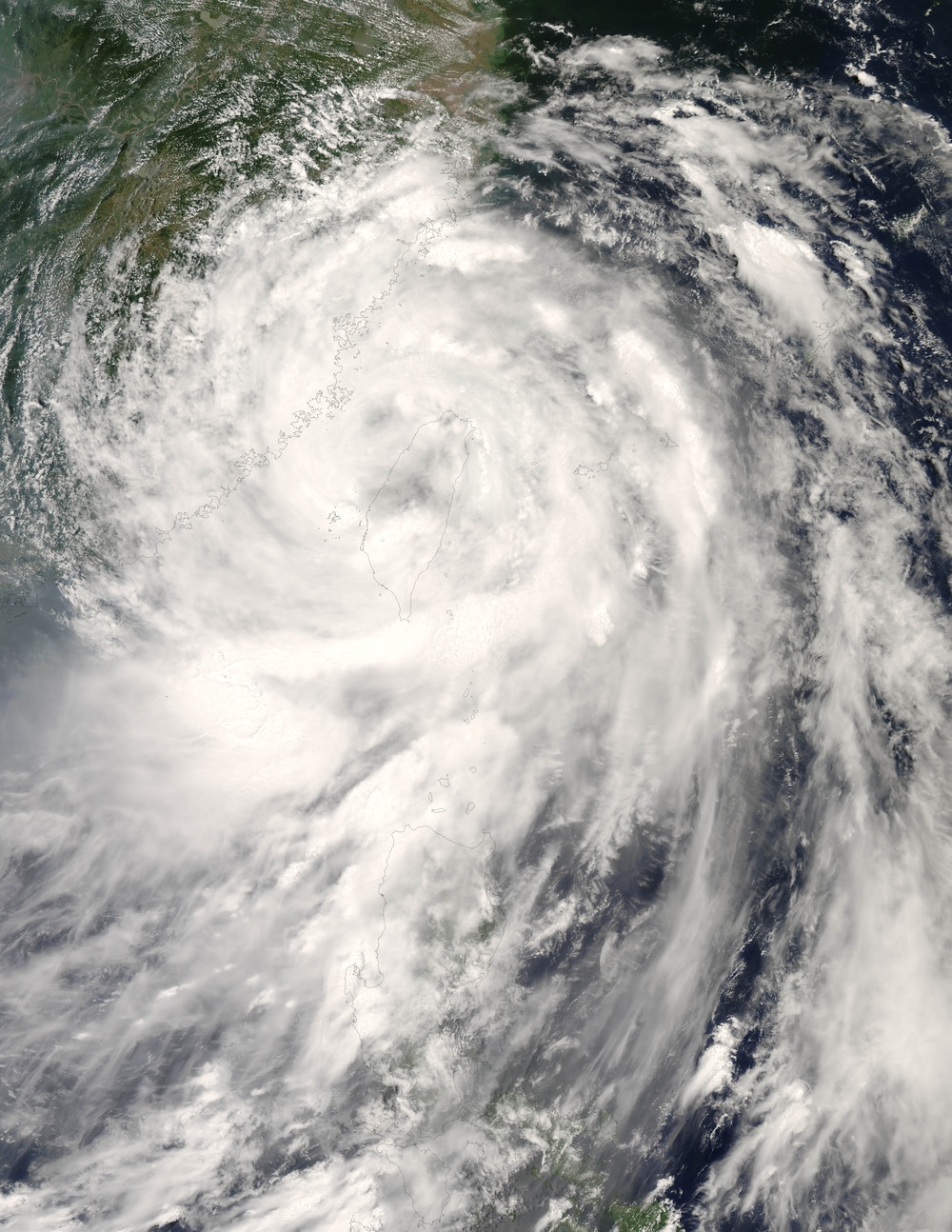
Typhoon Fung-Wong was lashing Taiwan and coastal China with high winds, rain, and storm surge on the morning of July 28, 2008, reported the news.bbc.co.uk/ BBC World News Service. The Category 2 typhoon had crossed Taiwan, with the center of the storm more or less bisecting the island. Most offices and businesses, including the stock market, were closed for the day.
This natural-color satellite image, obtained by the Moderate Resolution Imaging Spectroradiometer ( modis.gsfc.nasa.gov MODIS ) on NASA's aqua.nasa.gov/ Aqua satellite, shows Typhoon Fung-Wong as it appeared at 1:20 p.m. local time (5:20 UTC) on July 28, 2008. The storm had crossed Taiwan and was headed toward China. The crossing of Taiwan had disrupted the shape and power of the storm. The central eye was still evident in this satellite image, but no longer clear and well-formed.
After barreling its way across Taiwan, Fung-Wong weakened to Category 1 strength, but it still posed a significant threat to coastal communities in mainland China. Forecasters with the https://metocph.nmci.navy.mil/jtwc.php Joint Typhoon Warning Center were predicting the storm would make second landfall late on July 28 as a tropical storm.
The high-resolution image provided above is at MODIS' full spatial resolution (level of detail) of 250 meters per pixel. The MODIS Rapid Response System provides this image at rapidfire.sci.gsfc.nasa.gov/hidden/gallery/2008210-0728 additional resolutions.
You can also download a eoimages.gsfc.nasa.gov/images/imagerecords/20000/20286/Fung-wong.A2008210.0520.250m.kmz 250-meter-resolution KMZ file of the storm suitable for use with earth.google.com/ Google Earth.
NASA image by Jeff Schmaltz, rapidfire.sci.gsfc.nasa.gov MODIS Rapid Response Team, Goddard Space Flight Center. Caption by Jesse Allen.
| Date Taken: | 08.07.2011 |
| Date Posted: | 02.08.2013 03:18 |
| Photo ID: | 833735 |
| Resolution: | 6800x8800 |
| Size: | 4.03 MB |
| Location: | WASHINGTON, D.C., US |
| Web Views: | 5 |
| Downloads: | 1 |
