NEW ORLEANS - Growing up, did you ever do something that was, let’s say, less than advisable? Maybe climbing that particular tree wasn’t such a good idea? Maybe stepping on that particular elderly gentleman’s lawn ruined your day? Wouldn’t it have been great to have a friend there to tell you, "Hey man, that branch looks rotten?" Or, “I wouldn’t steal old man Wither’s lawn gnome, he throws a nasty hook." And wouldn’t it be cool if your friend could back up his recommendations with hard science?
The Coast Guard’s 8th District has that kind of friend.
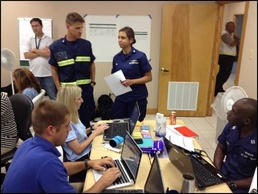
Coast Guardsmen in the 8th District tend to find themselves in worst-case scenario weather situations; it’s in the job description. Even though the Coast Guard is often first on scene in emergency situations, its assets aren’t invincible. The Coast Guard’s boats and helicopters have weather limits, which if exceeded, could prove to be disastrous for the crews.
Luckily, the meteorologists over at the National Weather Service in New Orleans have the district’s six. They are able to give the district highly detailed weather briefings to ensure that the Coast Guard’s missions in the Gulf go as safely as possible.
Ken Graham, Meteorologist-in-charge of NWS New Orleans, says that the relationship between the weather service and the Coast Guard really kicked off with the Deepwater Horizon response.
“It was having us be deployed there alongside the Coast Guard and being able to provide forecast for whatever operations the Coast Guard was doing,” said Graham. “It was telling the helicopter pilot where the fog is at so they could halt their operations until it burns off. Having that information provided a better response for Deepwater Horizon. “
The NWS isn’t required to help the Coast Guard. They do it because they can.
“There isn’t an official agreement, but it works,” said Graham. “The Coast Guard’s missions are so weather dependent. We provide a lot more than '20 percent chance of rain tomorrow’ and we can come up with a very detailed forecast for operations. Whether its marine or flight operations.”
NWS New Orleans has a team of meteorologists on site 24/7 and, as one might expect, they bring some high-tech weather gadgetry to the table.
“On a daily basis, there are at least two meteorologist around the clock. The watchstander is looking at model and weather balloon information. All that information is put into a database,” said Graham. “The watchstander will tweak that data for dozens of meteorological parameters at one kilometer grids reaching out seven days. So it’s a massive database of parameters that most of the time the public doesn’t know about.”
We provide forecast for visibility, cloud cover and timing of rain, said Graham. It’s all about the impacts. Being able to tweak meteorological information gives us a better picture of what’s going on and the Coast Guard can make a better decision on operations.
The 8th District is home to the Mississippi River, which stretches like a vertical spider web across the Heartland. Residents and Coast Guardsmen who call the district home know what a fickle mistress that river can be - flowing north instead of south, and if it’s not low water, it’s flooding. Guess what partner agency also has a watchful eye on water levels on the Mississippi.
“In our Lower Mississippi River Forecast Center, we have engineers and hydrologist,” said Graham. “What the engineers and hydrologists are doing in a large area is looking at hydrologic models to see what height the rivers are going to reach. When’s it going to reach flood stage, when is it going to crest? How high is it going to get? They are running all the models to get all the info on the rivers. Then they send those values to the public service desk and that person will actually turn that into a warning if you are going above flood stage. And that’s when everybody sees the banner on the bottom of the Weather Channel. When it comes to the atmosphere, the land the rivers and the sea, it’s all coming out of here.”
On everyone’s mind this time of year is the dreaded “H” word. With an active hurricane season anticipated this year, the Coast Guard will be looking to the weather service for some key information.
“For hurricanes, there are several different briefings we do each day with the Coast Guard; it’s a special briefing just for the Coast Guard,” said Graham. “A lot of it is getting the timing down. We talk about the tides and how high the seas are, all of that is forecasted specifically for the Coast Guard and it’s been a big plus. So, with us understanding what the Coast Guard’s requirements are we can provide those specific requirements. If we’re not working close together, we’re just blasting this information out. If we know specifically that the Coast Guard can’t do something if the seas are five feet, well, we have that information so if we link that catalogue of impacts together, then we can provide the Coast Guard with some information they can really use.”
Speaking of natural disasters, the Weather Service has a new pilot program that sends deployable first responders to the scene of the emergency.
“Our team raises the level of support of the weather services to our partners to the next level,” said Matthew Moreland, Emergency Response Meteorologist Team Lead, NWS New Orleans. “We are really focusing on decision support. Now we do more hands-on where we help our partners, including the Coast Guard, better interpret weather information. We are trying to develop and utilize as much new technology as we can. We now have a mobile tool that our partners can utilize.”
Mobile tool indeed. Enter the S.W.E.R.V., or Severe Weather Emergency Response Vehicle to us laymans. A converted Federal Emergency Management Agency trailer, the S.W.E.R.V. vehicle can serve as NWS New Orleans’ headquarters in the field post storm. It’s basically the weather service’s version of the Batmobile.
“We can basically bring this thing out anywhere,” said Tim Erickson, Emergency Response Meteorologist NWS New Orleans. “We hold meetings in the vehicle and brief responders pre- and post-hurricane. We pull the vehicle out before a storm and bring it back in after. Some times offices will lose power. This vehicle could actually act as our headquarters after a storm, so we don’t lose capability. We can still get the word out on the weather. If more severe weather is coming in, since we are in the field with our vehicle, we can get the word out immediately.”
The Coast Guardsmen of the 8th District, arguably one of the busiest districts in the Coast Guard, are often first into the fire, or water as the case may be, and with a little help from their friends, they can continue taking care of business on a daily basis. As sailors, it’s usually a good idea to keep a weathered eye on the horizon, but sometimes, it’s nice to have a friend there to do it for you.